Join Sara and I in Utah for a little high desert camping, hiking, and backpacking in Canyonlands National Park.
For this adventure, we did a 2 day, 1 night backpacking trip through the Needles District of Utah’s Canyonlands National Park, followed by a little day hike visit to Arches National Park on the way back to Salt Lake City to catch our flight back home. In fact, this was actually the first trip we’ve ever done via flight instead our usual road warrior routine. That being said, we still got at least a moderate dose of driving during this trip, as the drive from SLC airport to Moab and Arches NP is about 4 hours. From there it was another 1.5 hour drive south to the Needles District, the southernmost district in Canyonlands.
Full GPS track data and waypoints for this trip can be found on the Trip Data page.
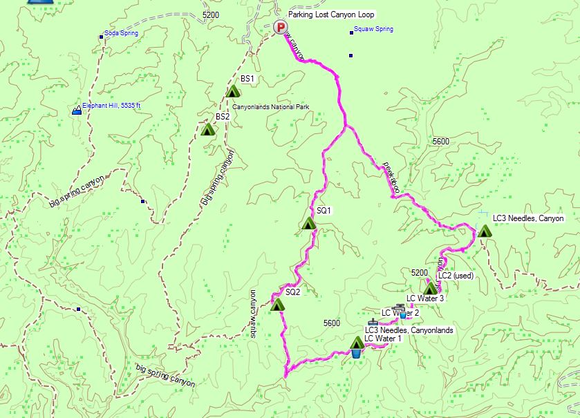
Here’s an overview of the route, highlighted in pink, that we took clockwise. As you can see, there are several other trails accessible from Squaw Flat parking lot, creating the potential for larger loop options.
Parking Location: Squaw Flat Trailhead ‘A’ 38.143017,-109.803700
Day 1 Trails Used (In Order)
Squaw Canyon Trail
Lost Canyon Trail
Camp at Lost Canyon Campsite 2 (LC2)
Total Mileage: 6 miles
Gross Elevation Gain: 768′
Gross Elevation Loss: 682′
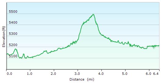
Day 1 Elevation Profile – Lost Canyon Loop
It should be pointed out that campsites in the Needles district are restricted to designated areas only, and must be registered in advance. This can can be done either online or in person at the visitor’s center and costs $30. Since I live about 2,000 miles away, and spots tend fill up well in advance, I went the online route. I reserved my spot about a month in advance and still managed to get the spot I was after, but I could see other areas that were already booked up pretty solid. When stopped in the visitor’s center on the day of our hike in, we caught a glimpse of the availability board and I was hard pressed to see any open spots, so reserving on the same day in person probably isn’t the best game plan. The nice thing is, the spots seem to be nicely spread out. For instance, there were three campsites in the entire Lost Canyon area that we chose to visit, with about a mile of trail in between them. So, while we did have to be a bit more rigid in our planning than usual, and the $30 fee was definitely the highest I’ve ever paid for backcountry permit, we really did feel like we had a whole canyon to ourselves to call home for the afternoon and night. The site was also tucked back a decent way off the main trail and situated with an amazing view. I’m sure all the spots are awesome, but I would highly recommend LC2 to anyone on the fence about where to camp in Canyonlands. It was a great spot.
Speaking of things that make a campsite great, Lost canyon was one of the few areas in Canyonlands NP I could find in my research that had a high probability of reliable water. We crossed over several water sources within less that a mile of the campsite, due to the fact that the sites are located in the bottom of a relatively lush canyon within close proximity to the brook that runs though it. It’s quite a stark contrast to the treeless universe or rock, sand and sun lying only a few hundred feet above. It also didn’t hurt that the area experience some decent rains and flash flooding several days before. I tagged a couple of these spots in a GPS file for this trip using my trusty Garmin Oregon 650
Day 2 Trails Used (In Order)
Lost CanyonTrail
Peekaboo Trail
Squaw Canyon Trail
Return to Squaw Flat Trailhead A and parking lot.
Total Mileage: 3.8 miles
Gross Elevation Gain: 427′
Gross Elevation Loss: 440′
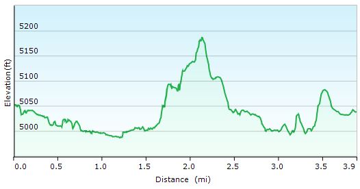
Day 2 Elevation Profile – Lost Canyon Loop
I’ll save the full story for the video, but this was truly an amazing trip! I’ll tell you what though, southern Utah may bitten me and infected me with the desert bug. Hmmmm, where to next…
Stat Totals for the Full 2 Day Loop
Total Mileage: 9.8 miles
Gross Elevation Gain: 1,195′
Post Hike Burger Joint of Choice
Moab Brewery
686 S Main St, Moab, UT 84532
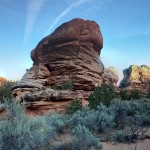
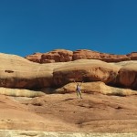
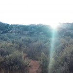
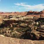
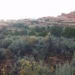
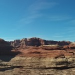
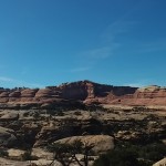
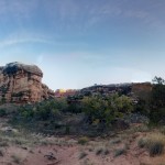
Annnnnd, for good measure, here’s a gallery of some of Sara’s “VR Panorama” and and regular panorama shots that she had fun playing with using her phone’s camera app.