
Come along for 4 days of hiking, backpacking and camping in Maine.
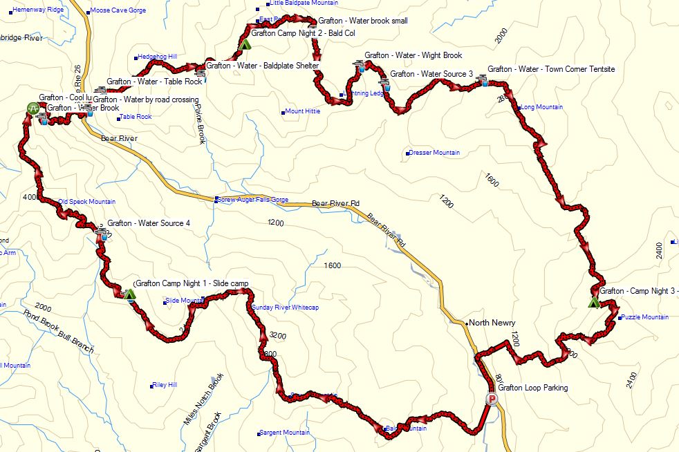
For this trip, we’ll be backpacking a loop hike of the Grafton Loop in Maine’s Grafton Notch State Park. Full GPS track data along with points of interest (campsites, water sources, etc) available for download on the Trip Data Page.
Grafton Loop – Route Overview
The Grafton Loop is a roughly 39 mile, 9 summit hiking loop formed by connecting a portion of the Appalachian trail with the Grafton Loop Trail. Portions of the trail traverse both Maine’s Grafton Notch State Park as well as a good deal of private land. For this reason, designated campsites are mandatory for most of the loop’s route, along with a restriction on campfires. For those of you who like to stealth camp, you’ll have to do a bit more planning for this trip. It took several years to come to an agreement with all of the land owners the that trail traverses, so it’s best to stick to the script and keep them happy so we can continue to enjoy this route.
The four of us chose to do the loop clockwise over the course of 4 days. Many people choose to do it in 3 days, and a rarer few do it in 2. Don’t be deceived by the rolling beauty of the photos you see though – the Grafton Loop is still in the White Mountains region and has it’s fair share of strenuous elevation and steep inclines, littered with roots and rocks. If rain is expected, be prepared to move carefully on the many sections of solid and potentially slick rock faces on the balder summits. We stacked up nearly 13,000 feet of elevation gain over the course of our trip. Not too shabby. For comparison, that’s almost 3,000 more feet than the Pemi Loop. Be aware of your group’s capability, as well as desired amount of relaxing versus mileage, and plan your number of days accordingly.
Summits: Bald Mountain, Puzzle Mountain, Long Mountain, Lightning Ledge, Old Speck, West Baldpate, East Baldpate, Miles Notch, Sunday River Whitecap
Parking: 985 Maine 26, Newry, ME 04261 Near intersection of Rt 26 and Eddy Rd
Hike approximately one half mile south from parking lot to the Grafton Loop Trailhead located at 44.530831,-70.825252. Note: Parking is not allowed here at this trailhead, hence the road hike.
Trails Used Day 1:
Grafton Loop Trail
Setup camp at the Slide Mountain Campsite
Day 1 Mileage: 10.86 miles
Day 1 Gross Elevation Gain: 4,094′
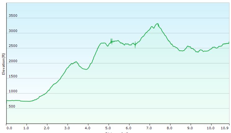
Elevation Profile Day 1
Trails Used Day 2:
Old Speck Trail / Appalachian Trail
Grafton Loop Trail
Stealth camp in col between West Baldpate Mountain and East Baldpate Mountain
Day 2 Mileage: 11 miles
Day 2 Gross Elevation Gain: 4,364′
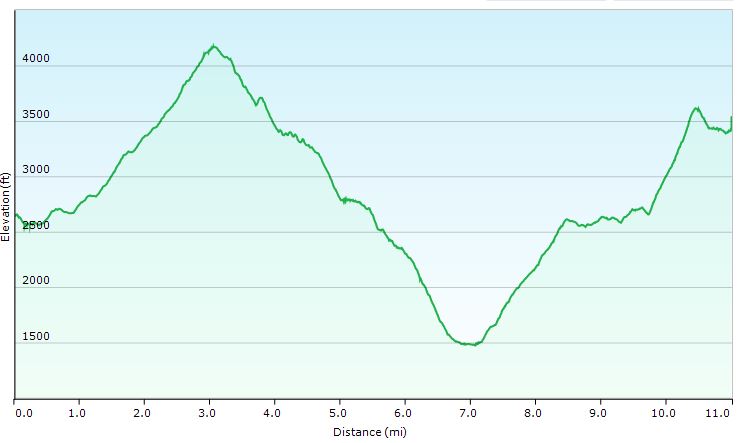
Elevation Profile Day 2
Trails Used Day 3:
Grafton Loop Trail
Setup camp at Stewart Campsite
Day 3 Mileage: 13 miles
Day 3 Gross Elevation Gain: 3,596′
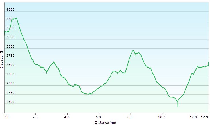
Elevation Profile Day 3
Trails Used Day 4:
Grafton Loop Trail
Return to parking lot and Graton Loop Trailhead on Rt 26
Day 4 Mileage: 4.5 miles
Day 4 Gross Elevation Gain: 843′
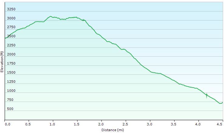
Elevation Profile Day 4
Trip Totals:
Distance: 39.36 miles
Gross Elevation Gain: 12,807′
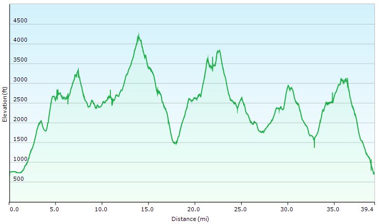
Elevation Profile for Entire Route
-
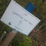
- Our trip began here, at the Grafton Loop’s western trailhead.
-
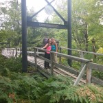
- Snowmobile Bridge
-
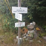
- A more laid back Grafton Loop sign.
-
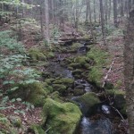
- Mossy rocks on our first ascent.
-
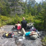
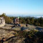
- Lunch break on Day 1
-
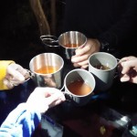
- Mike’s Orange Creamsicle cocktails that he made to celebrate the end of Day 1.
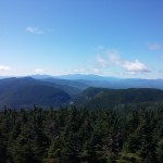
-
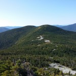
- Offers a great view of the Grafton Loop, and far beyond.
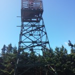
-
- View from Fire Tower
-
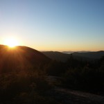
- Our view as we ate breakfast on Day 3.
-
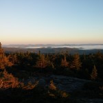
- As seen from in between West and East Balpate mountains.
-
- Preparing some breakfast on the Baldpates.
-
- Looking back on West Baldpate
-
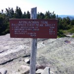
- From here we left the AT and rejoined the Grafton Loop Trail.
-
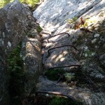
- One of two sections on the Grafton Loop that employ the use of iron ladders.
-

- Sara and Danielle always manage to find a spot to kick back…
-

- Mission Complete!