Join me for 3 days of Winter Camping, Backpacking & Hiking in the Smoky Mountains.
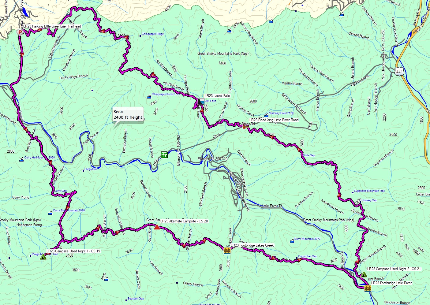
For this winter camping adventure, I decided to do a solo backpacking loop along the Little River Gorge in Tennessee’s western region of Great Smoky Mountains National Park. The Little River is flanked to the south by Meigs Mountain and to the north by Sugarland Mountain. By hiking trails along the ridges of both these mountains, I was able to create a 25 mile loop with 6,000 feet of gross elevation gain.
On the first night, I chose to camp on top of Meigs Mountain at campsite 19, Upper Henderson. On day two I planned to descend into the gorge to camp along the Little River at campsite 21. On the third day, I would hike up Sugarland Mountain towards Laurel Falls and ultimately, Little Brier Gap to complete the loop.
For sleep and shelter, I packed in my Outdoor Vitals Fortius trekking pole tent, a 3-season sleeping pad and my Hammock Gear 20° down quilt. Despite it being the middle winter, my temp range was relatively mild with lows in the 40’s and highs touching the mid 60’s. This allowed me to leave my extra cold weather clothing layers at home, so I was still able to use my ultralight backpack instead of the larger pack that I typically use for winter. Days 2 and 3 had a forecast of rain and high winds, so I played it safe and packed in full set rain gear as well.
A backcountry permit is required for all campsites in this area. You can reserve them for $8 per night on the Smoky Mountains National Park website here.
Full GPS track data, including campsites, water sources, etc, for this trip and many others can be downloaded on my Trip Data Page.


