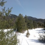
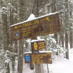
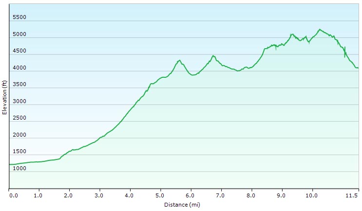
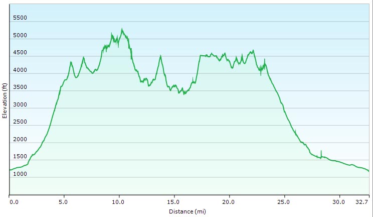
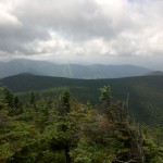
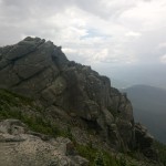
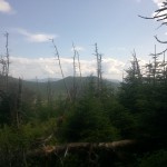
Come along for 3 Days of Hammock Camping, Hiking, and Backpacking on a classic Pemi Loop in New Hampshire’s White Mountains.
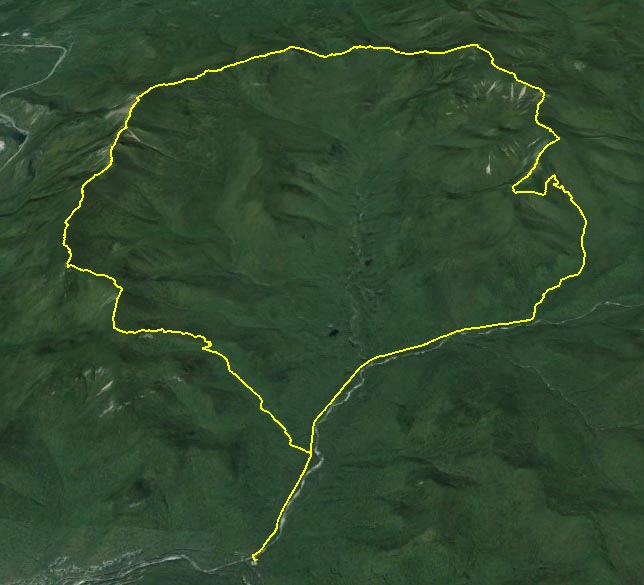
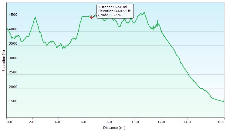
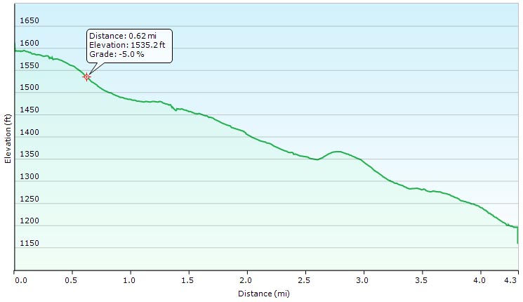
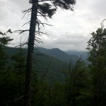
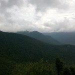
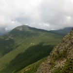
The Pemi Loop, made popular by it’s distinction as one of “America’s Hardest Day Hikes” in a May, 2005 Backpacker Magaizine article, is not actually an “official” trail, but rather a series of AMC (Appalachian Mountain Club) trails joined to create a 31.5 mile tear drop shaped loop in New Hampshire’s Franconia Wilderness Area. GPS track data is available on the Trip Data page.
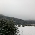
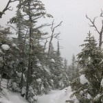
For this hike, I’ll be solo hammock camping with my Hennessy Hammock and the larger 12′ x 10′ Deluxe Hex Tarp, due to the threat of cold and wet late summer weather. In the White Mountains, weather can turn on a dime even with the brightest of forecasts, so when the weather report actually says things are going to be iffy, you’d better take it seriously. For this trip we’ll experience a wide range of conditions – from hazy summer heat, to gusty bursts of hail and chilling nighttime lows.
Join us for 4 days of hammock camping, hiking and backpacking in North Carolina’s Linville Gorge wilderness area.
Located in the Pisgah National Forest, Linville Gorge – or simply “The Gorge” as local hikers prefer to call it – is a 12 mile long gorge carved into the surrounding southern Appalachian mountains by the Linville River. The distance from upper ridge to the river below is roughly 1,400′, which coupled with the network of minimally maintained wilderness trails and unofficial trails, can make for quite a rugged experience. This is not the rolling mountain experience offered up by the neighboring Smoky Mountains, lumbering just 75 miles to the west. The Gorge has a reputation for being a bit of a beast. And yet for some reason I couldn’t help but notice a permanent trace of laziness in the air.
Typically, I quite enjoy the hustle of a good long distance hike. The more miles, the more exciting the trip, but Linville Gorge quickly had a different affect on me. I spent most of my time on the trail daydreaming about the next time I could be swinging in my hammock. Which was perfect because Mike and I had 4 days off and nothing to do but just that.
Speaking of days off, it should be pointed out that the Forest Service has enacted a consecutive stay limit of 2 days, 3 nights for camping within the Linville Gorge wilderness area. Fortunately, the surrounding Pisgah National Forest does not have such restrictions. With a little planning, you can easily spend a night just outside the limits of the wilderness area and you’re good to go. There are decent opportunities for this strategy along the western side of the Gorge, where the Mountains to Sea Trail follows along the boundary line. From May 1st through October 31st there is also a permit required for back-country camping on weekends and holidays. Thankfully, it’s free and simple – I called a few weeks beforehand and they actually faxed me our pass within a half hour or so.
If you decide to plan a trip of your own, I highly recommend heading over to the forums on Linvillegorge.net. The Gorge Rats have a wealth of knowledge and are very friendly and helpful to those of us noobs looking to rummage through The Gorge. There’s also treasure trove of goodies for your GPS including potential camp sites, water sources, official and unofficial trails, points of interest, etc.
Full GPS data for this trip, recorded with my Garmin Oregon 650, is available for download on the Trip Data page.
Parking Location:
Conley Cove Trail Head N35 53.414 W81 54.380
Link to Nebo Water Gauge: http://waterdata.usgs.gov/usa/nwis/uv?02138500
There are currently no bridges across the river, so trust me, you want to keep an eye on this. Readings of 100 cfs or less seem to be ideal. 200 cfs will create approximately waist deep conditions.
List of Trails Used, Day 1:
Conley Cove Trail
Linville Gorge Trail (Follows river along bottom of gorge)
Set up camp near the banks of the Linville River Mileage for the Day: 10.9 miles
Elevation Gain: 1,627′
Elevation Loss: 2,185′
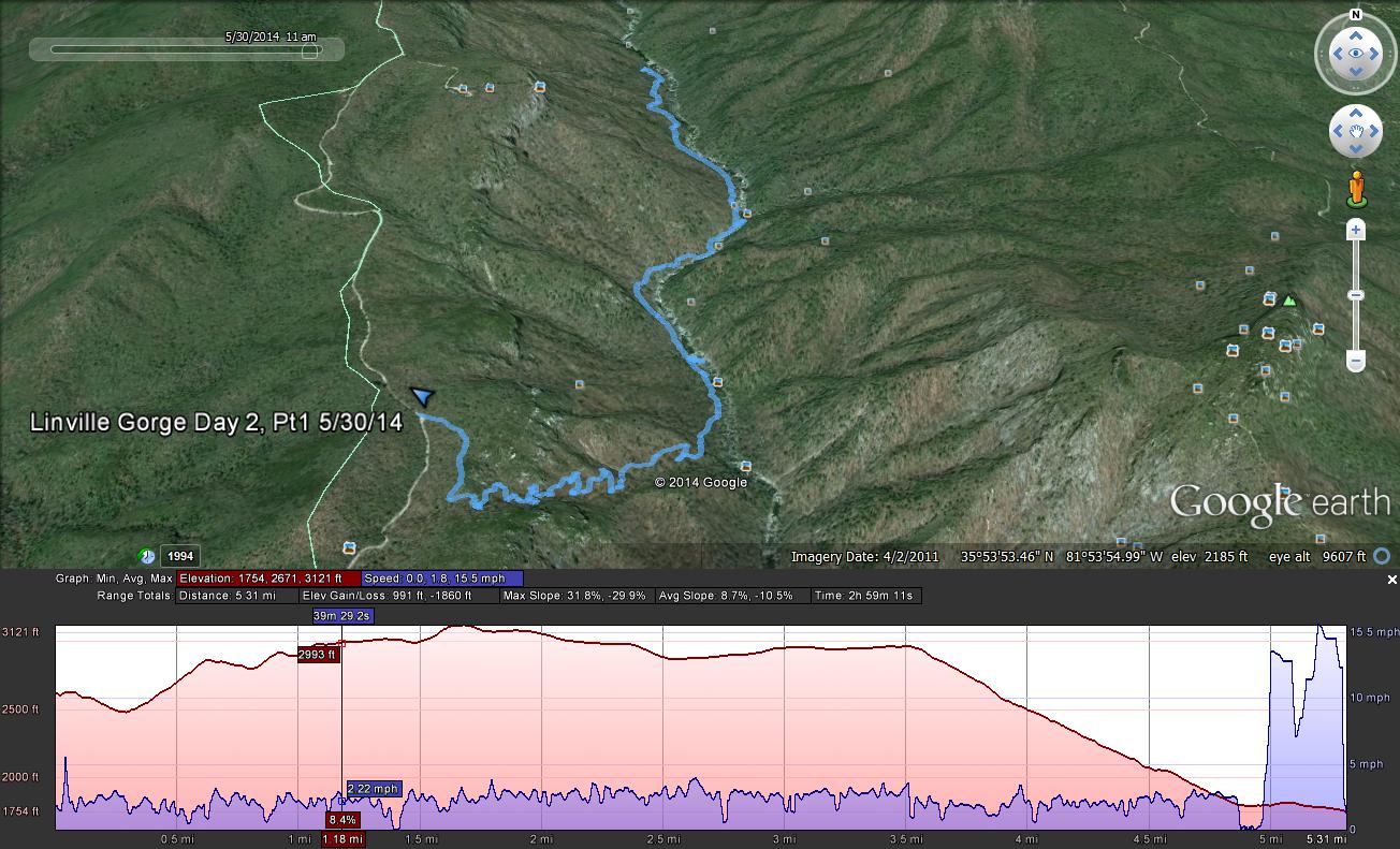
List of Trails Used, Day 2, Part 1: Return to Car via Conley Cove and LGT
Drive to second location. Mileage for the Day Part 1: 3.9 miles
Elevation Gain: 1,204′
Elevation Loss: 535′
Route for First Day and Second Morning
Second Parking Location:
Wolfpit Trailhead N 35 49.449 W 81 53.365
List of Trails Used, Day 2, Part 2:
Wolfpit Trail
Mountain to Sea Trail (MST)
Set up Camp along cliff near Shortoff Mountain Mileage for the Day Part 2: 2.3 miles Elevation Gain: 1,109′
Elevation Loss: 75′
List of Trails Used, Day 3: Continue on Mountain to Sea Trail (MST)
Set up camp along the MST, outside of wilderness area. Mileage for the Day: 6.3 miles Elevation Gain: 840′
Elevation Loss: 1,112′
List of Trails Used, Day 4:
Reverse course on the Mountain to Sea Trail (MST)
Shortcut via Jeep Trail (circumvents Day 2 Campsite)
Wolfpit Trail
Return to Wolfpit Parking area and car Mileage for the Day: 5.8 miles Elevation Gain: 892′
Elevation Loss: 1,795′
Total Mileage for Trip: 29.2 miles Total Elevation Gain for Trip: 5,672′ Total Elevation Loss for Trip: 5,702′
Route for Days 2 – 4
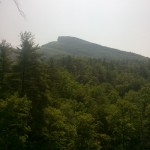
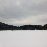
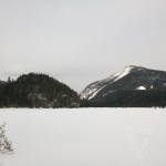
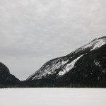
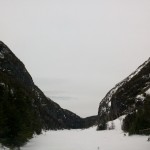
Looking up towards Hawksbill Mountain from the Linville River.
Looking down upon the Linville River, just north of the former Spence Bridge.
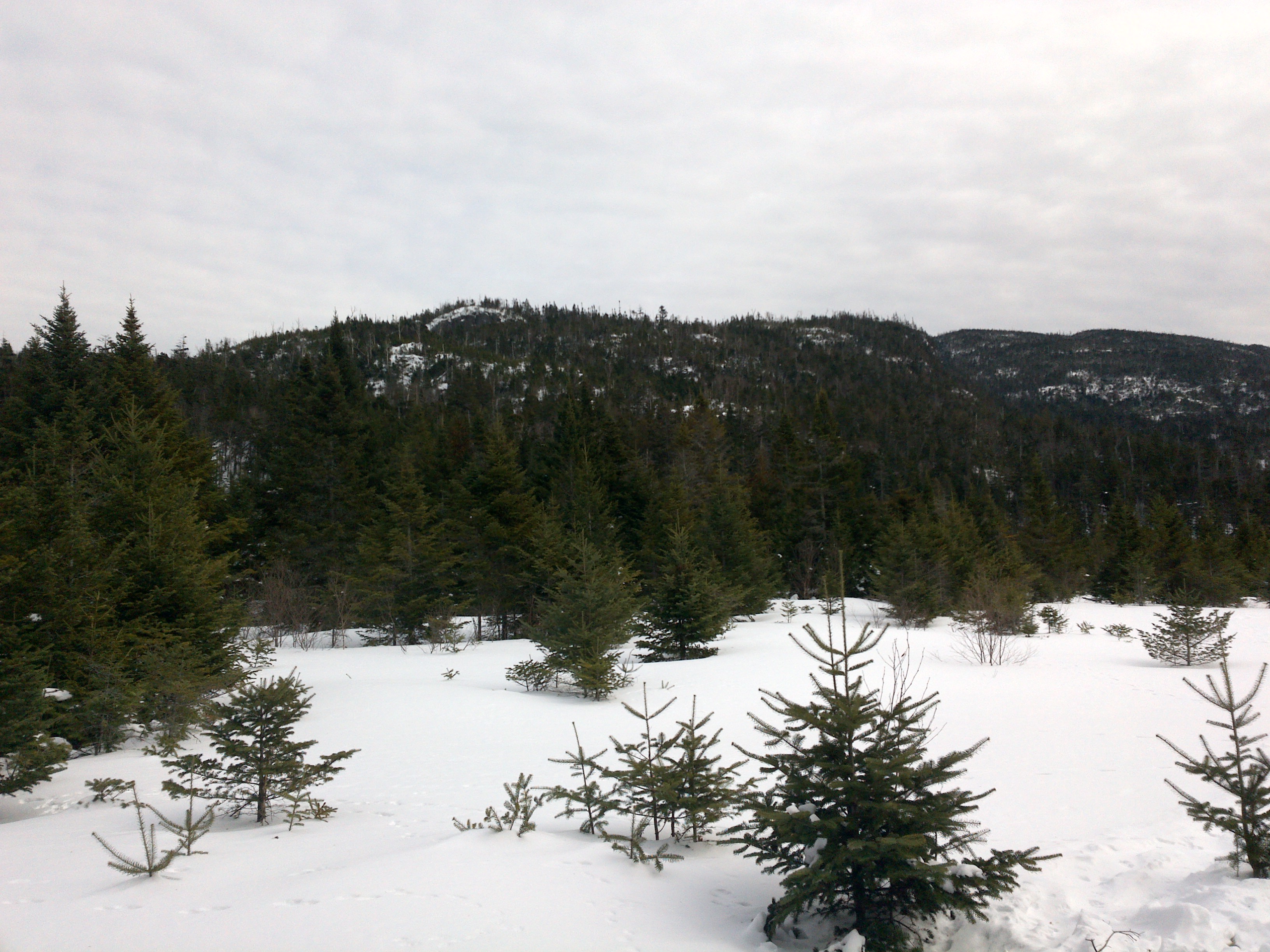
Three days of Winter Hammock Camping and backpacking in the Adirondacks High Peaks Region.
GPS track data for the full trip was recorded using my new Garmin 650 gps unit, and can be found on the Trip Data page, for download in GPX format. (All photos in this post are geo-tagged as well)
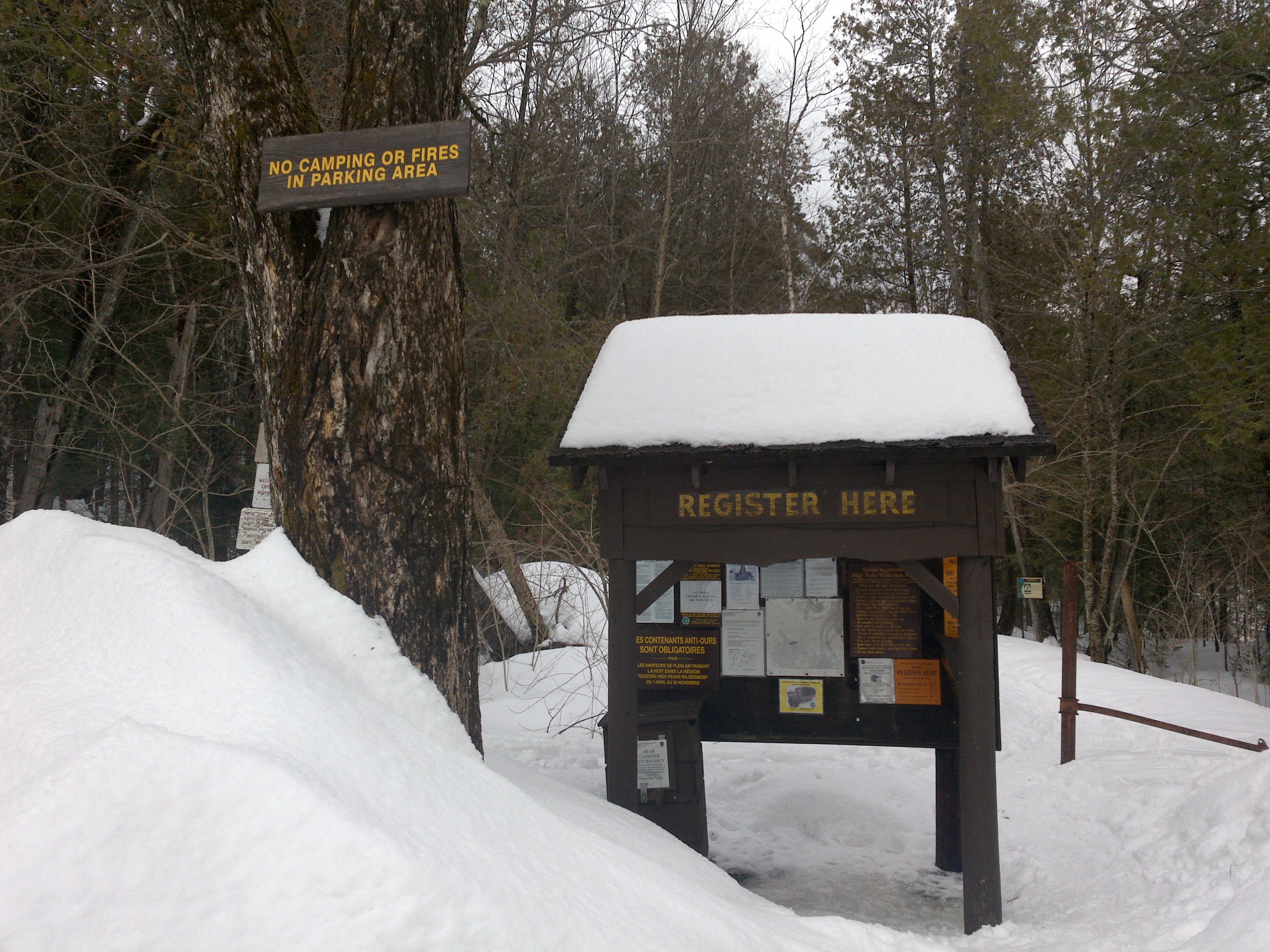
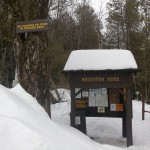
Parking Location: At the end of Upperworks Road 44°05’20.6″N 74°03’22.7″W
The Upperworks Trailhead Parking Area
Trails Used in Order:
Day 1 (Hike In)
Begin at Upperworks Trailhead
Calamity Brook Trail
Cross frozen Lake Colden towards the Ranger Station
(If lake is not frozen, the Algonquin Peak Trail can be taken instead)
Take Avalanche Pass Trail to visit Avalanche Lake
Reverse course on Avalanche Pass Trail back towards Lake Colden
Camp near intersection of Ranger Station Spur Trail and Cold Brook Trail
Campsite coordinates N44 07.494 W73 58.912
Mileage Total: 9.16 miles
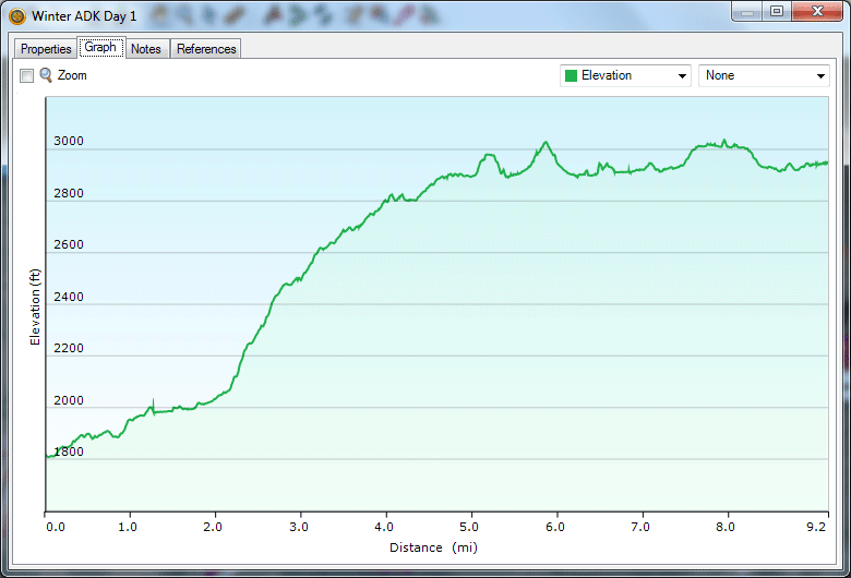
Elevation Profile for Day 1
Day 2 (Above Treeline Excursion)
Avalanche Pass Trail
Algonquin Trail via Lake Colden
Enjoy the views (or summit fog) and head back down towards campsite Mileage Total: 4.16 miles
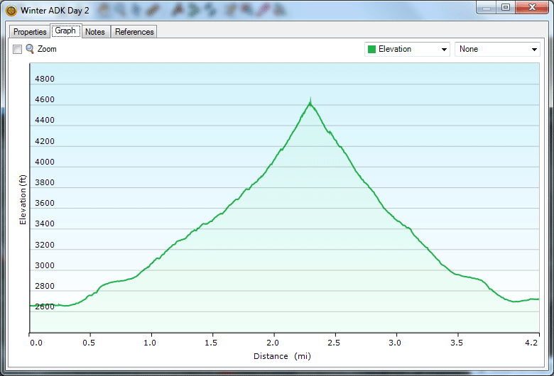
Elevation Profile for Day 2 (Ouch)
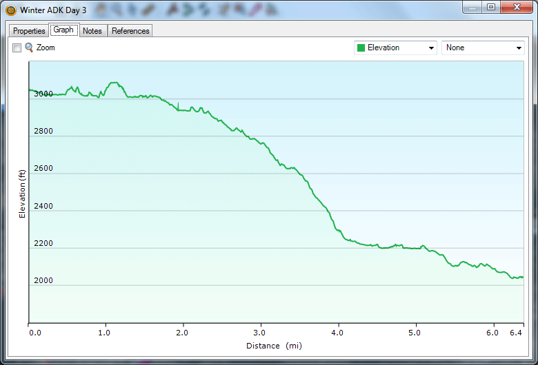
Day 3 (Hike Out)
Head out across frozen Lake Colden back towards car
Calamity Brook Trail
End back at Upperworks Trailhead
Mileage Total: 6.38 miles
Elevation Profile for Day 3
Returning to the Upperworks Parking area, via Calamity Brook Trail
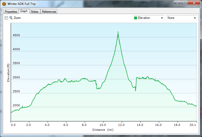
Mileage & Elevation Profile for Full 3 Day Trip
For a look at my winter gear, check out my Winter Gear List Video. Notable changes: Hammock instead of Kelty Salida 2 Tent, MSR Rapidfire Stove instead of generic upright canister stove, and I picked up another pair of fleece lined hiking pants as an alternative to the backup sleeping pants I used to pack.
The Upperworks Trailhead Parking Area
Hiking in from the Upperworks Trailhead
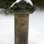
View of Calamity Pond
Memorial marker for David Henderson at Calamity Pond
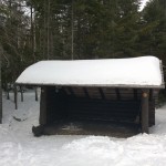
One of several Lean-to’s in the Lake Colden area
Heading across Lake Colden towards the MacIntyre Range
View from atop the frozen Lake Colden (Mount Colden to the Left)
Another view from atop the frozen Lake Colden (Mount Colden to the Left)
View seen while standing on frozen Avalanche Lake.
Trail Junction near Campsite that was chosen.
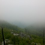
Fog on the Algonquin Trail
Ice flow along the upper portion of the Algonquin Trail
Returning to the Upperworks Parking area, via Calamity Brook Trail
All video content, photos and music are original works by myself, Sintax77.
Join us for some Winter Camping and high winds Backpacking in the Pemigewasset Wilderness.
For this backpacking trip, we’ll be hiking the Pemigewasset Wilderness, within New Hampshire’s White Mountains National Forest. Our primary summits of choice will be the Twin Mountains – specifically, North Twin Mountain, and South Twin Mountain. Continue reading →
Come along for 2 Nights of November Fall backpacking and hiking in Kentucky’s Red River Gorge.
For this adventure, we’ll be visiting a very unique Geological Area within Kentucky’s Daniel Boone National Forest, called Red River Gorge. This area hosts an impressive collection of natural arches (or natural bridges, as they are often call), spread across some relatively young forest in the hills of eastern Kentucky, about 1 hour shy of Lexington. In fact, Red River Gorge has the highest concentration of rock arches east of the Rock Mountains (over 100). This makes Red River Gorge a visually impressive hiking area, as well as one of the world’s top rock climbing destinations.
I’ll be hiking a 3 day, 2 night backpacking loop through the heart of the Geological Area, which is flanked by the Clifty Wilderness area to the East and Natural Bridge State Resort Park to the southwest.
For those of you who interested, I recorded full GPS track data for each day’s hike, which can be downloaded on the Trip Data page.
For a thorough overview of my backpacking gear used and complete gear list, check out this video post: Ultralight Backpacking Gear List (the only substantial changes for this trip were heavier boots and a 30 degree sleeping bag instead of lighter fleece bag)
Day 1
Bison Way Trail 210
Sheltowee Trace Trail 100
Cross State Road 715 and River via suspension bridge
Rough Trail 221
Gray’s Arch Trail 205
Set up camp near Gray’s Arch (must be at least 600 feet away)
Stats for Day: 13.1 Miles ; 4,652 feet of elevation gain ; 4,425 feet elevation loss
Day 2
Gray’s Arch Trail 205
Pinch-em Tight Trail 223
Buck Trail 226
Koomer Ridge Trail 220
Hidden Arch Trail 208
Cliff Trail 206
Silvermine Arch Trail 225
Koomer Ridge Trail 220 (backtrack and continue)
Set up camp near junction of Koomer Ridge Trail and Rough Trail
Stats for Day 2: 13.5 Miles ; 3,913 feet of elevation gain ; 4,125 feet of elevation loss
Day 3
Rough Trail 221 (short segment towards Sheltowee Tr )
Sheltowee Trace Trail 100
Road Hike along Red River back towards Bison Way parking area.
Stats for Day 3: 3.29 Miles ; 561 feet of elevation gain ; 574 feet elevation
Grand Totals for Trip: 29.89 Miles ; 9,126 feet of elevation gain ; 9,124 feet of elevation loss


 , is available for download on the
  with standard tarp
 with
with Carabiners
 (12’x12′)
 for tarp pullouts
 with Black Diamond Neutrino Carabiners