2 days of Backpacking and Campfire Cooking in Alabama’s Sipsey Wilderness.
For this two day, one night backpacking and camping trip, I returned to the Sipsey Wilderness along with my wife Sara, and our dog Denali. Located in Alabama’s upper northwest corner, within the greater Bankhead National Forest, this wilderness area is true hidden gem, decorated with sandstone canyons, high bluffs, meandering creeks, and waterfall-studded hollows.
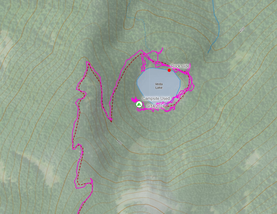
Starting from the same Borden Trailhead that I used for my previous backpacking trip, we took a shorter alternate route to a different area to try out a new campsite along the creek. We traded mileage for time at camp on this trip, with an emphasis on lounging and campfire cooking.
Our main menu item would be campfire tacos for dinner with fresh ground beef and all the fixings. For breakfast and lunch the next day we had two options – Spicy Cilantro Jalapeno ramen and classic grilled cheese. Our dog packed in his own food in his doggy backpack, and if he played his cards right, he might even get some doctored up dog food from our supply of fresh ingredients.
Despite being only a week after my previous trip, our temperature range was much warmer this time around with a nighttime low only in the mid 60’s and daytime temps in the 70’s.
If you’re wondering how we got away with packing in raw meat and fresh ingredients, the solution was pretty simple. We froze our ground beef the night before and packed it alongside of our fresh lettuce, cilantro, sour cream, etc in a reusable grocery bag. We then made sure to pack that food bag deep in my backpack under all of my other gear. By the time we got it out to begin cook the beef was still slightly frozen and all of the other ingredients were still ice cold as well.
For shelter, we packed in a 4 person backpacking tent, budget two person sleeping bag, some inflatable sleeping pads and even some fluffy backpacking pillows. There was a slight chance of rain the next day, but we took our chances and setup the tent without the rain fly on for a little breeze and a nice view of the stars at night. With a little bit of luck, we would be out of the tent the next morning before the rain arrived.
As for the terrain, elevation gain isn’t much of an issue in the Sipsey Wilderness, but it does have it’s share of sections where the trail system that feels more like a riddle than a map. There are no trail blazes and many of the intersections are unsigned. I also learned the hard way that when there are trail signs, they are labeled with numbers, not names, so keep that in mind when choosing your map to go off of. It’s easy to miss a turn and end up at an unexpected bluff edge, but that’s kind of the fun part, right?
Geologically, the Sipsey Wilderness is located on the southern rim of the Appalachian Plateau, where layers of 300 million year old sandstone have been carved out by the flowing creeks and streams. The result is one of the most waterfall-rich regions in the eastern US. I only had a chance to see a handful of them on this trip, so there’s plenty more to see on future trips.
Native American tribes like the Yuchi and Cherokee traveled and lived among these same hills and waterways for centuries before the area was later logged, mined, and eventually protected under the Wilderness Act in 1975. Today, remnants of old wagon roads, homesteads, and mill sites can still be found in parts of the Sipsey Wilderness and Bankhead National Forest.
Trailhead Used: Borden Trailhead, 34.30905, -87.38986
Bunyan Hill Rd, Moultan, AL 35650
This is an easily accessible dirt parking area with room for a half dozen cars or so with no parking fee. No permits are required camp in the Sipsey Wilderness.
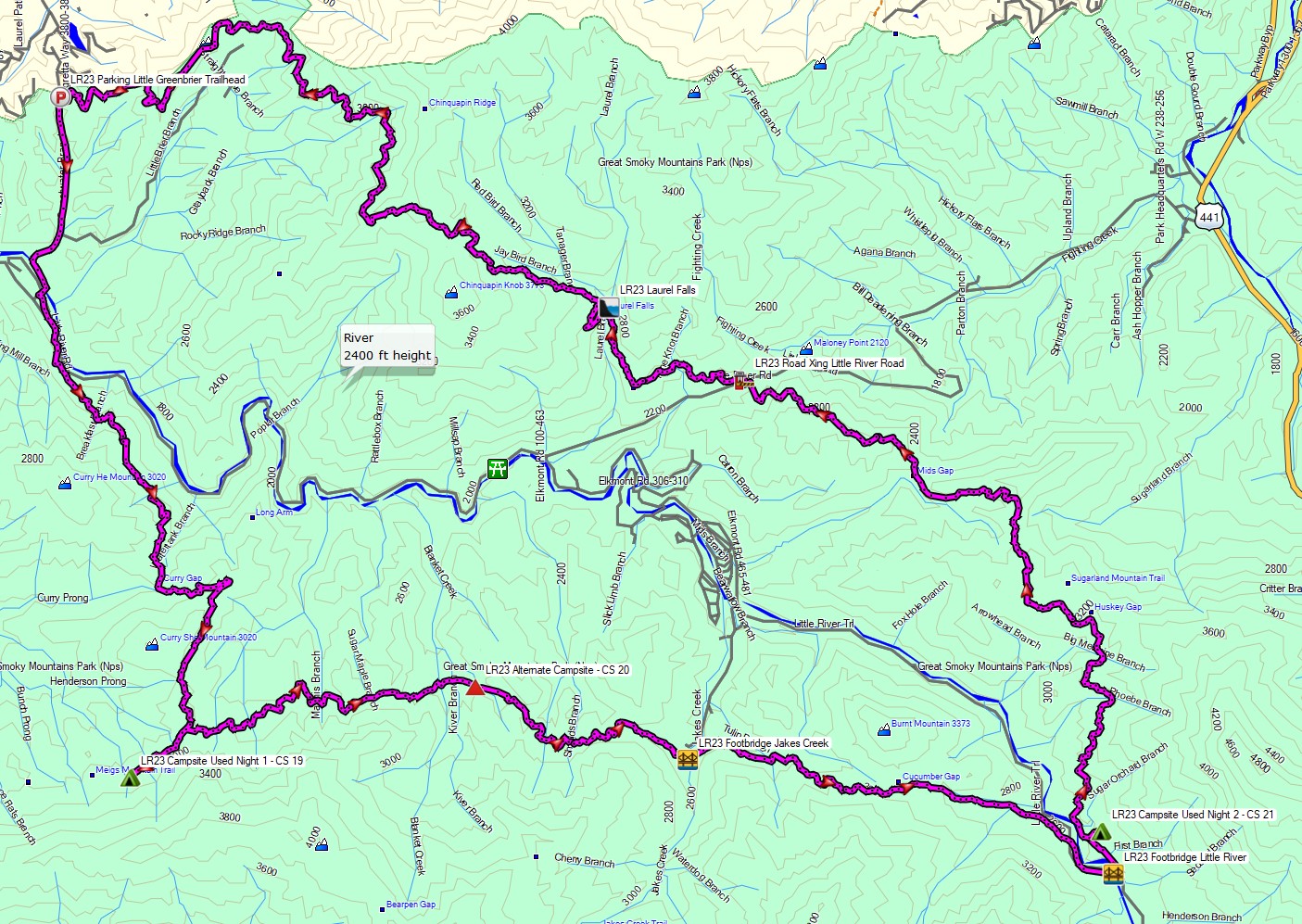
Here’s a helpful map that I found after doing the trip. All of the trails are labeled with the official trail numbers, unlike the maps I had. Maybe it will help you avoid the confusion that I had on this trip!
Trails Used
- FT 210 via the Borden Trailhead
- Cross Borden Creek
- Continue on FT 210
- Setup Camp along Forest Trail 210 and the adjacent Braziel Creek.
- Thera are several established campsites along Braziel Creek with firepits and easy access to water. The first one is after only 2 miles or so. Take your pick and enjoy the view!