Winter Camping in a Snow Storm on North Fork Mountain, West Virginia.
FTC Disclosure: This post contains affiliate links, which means I may receive a commission for purchases made through some of my links.
For this winter backpacking trip, we set out to do some overnight camping in the Monongahela National Forest by an awesome vista known as Chimney Top during the last week of January. The weather forecast showed the potential for a snow storm to land some time between the first night and the morning of the next day, so we decided to keep our mileage fairly low and laid back. Temperatures were projected to be fairly steady in the low to mid 20’s Fahrenheit.
Our initial climb up to the ridge would require a gross elevation gain of roughly 2,000 feet over the course of two miles. Once we got to the ridge, we would be afforded with seemingly endless mountain views overlooking the Potomac River, New Creek Mountain, and Dolly Sods in the distance. After following the ridge for a while we would start to look for campsite opportunities.
Besides the quick elevation gain, our main challenge on this trip would be water. There is only one semi reliable water source on the entire 25 mile length of the North Fork Trail, and it’s located right around the half way point at 12.5 miles. We wouldn’t be going that far, so we would have to pack in all of our water for drinking and cooking. If the snow storm had hit prior to our arrival, we would have had the advantage of melting snow. With the ground dry and free of snow upon our arrival, we decided to pack in 1 gallon (4 liters) of water per person.
For shelter, Frank and James went with tent camping in individual tents, while I chose to go with a hammock camping setup. With this mix of shelters, we hoped to be able to find a decent spot to camp on the ridge with some nice mountain views.
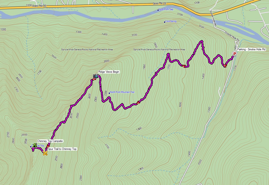
Route Overview – North Fork Mountain Trail Chimney Top – Sintax77
No permit is required to backcountry camp in the Monongahela National Forest.
Full GPS track data, including campsites, etc, for this trip and many others can be downloaded on my Trip Data Page.
Trailhead Used: North Fork Mountain Trailhead, Northern End
38°58’53.0″N 79°13’53.8″W
Smoke Hole Rd, Cabins, WV 26855