
Some say it’s the Toughest, most Dangerous Hiking Trail in the east. We set out on a backpacking trip to find out how tough the Devil’s Path trail really is.
Set in New York’s Catskill Mountains, the Devil’s Path is a 24.6 mile long end to end hike on steep, rocky terrain with around 8,500 feet of elevation gain and and 9,000 feet of elevation loss.
The mountain range that the Devil’s Path traverses is basically one large plateau with a handful of deep notches carved into it. The result? Almost all of the elevation change is crammed into a handful of 1 mile or less stretches, with little to no distance in between each ascent and descent. Scrambles, loose rock and mazes of gnarly roots add to the challenge.
Myself, Kyle from the Trail Tails Podcast and Flossy packed up our backpacks with some tents and hammocks and hit the trail on a mid-August morning to find out if this hiking trail would live up to it’s devilish reputation.
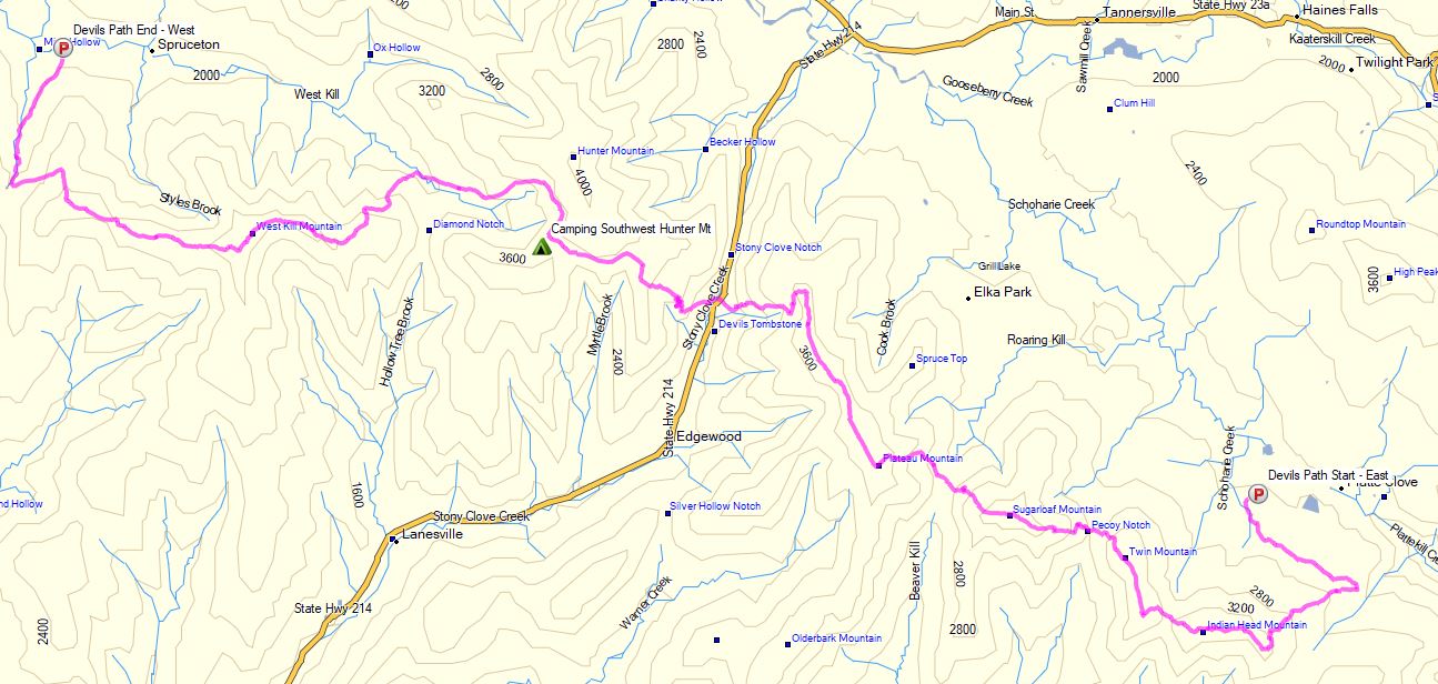
Catskills Devil’s Path Route Overview – Sintax77
There are 5 Major Summits (Catskill 35ers) on this hike
- Indian Head Mountain 3,573′
- Twin Mountain 3,652′
- Sugar Loaf Mountain 3,806′
- Plateau Mountain 3,840′
- West Kill Mountain 3,880′
Starting Trailhead Used (East): Platcove Trailhead , 42°08’02.5″N 74°06’16.1″W
Prediger Trail Road, Elka Park, NY 12427
This is an easily accessible parking lot with room for a decent amount of cars, but it does reportedly fill up by early morning on weekends.