Hiking Halfmoon Mountain – Camping & Backpacking in West Virginia

Solo Backpacking, Hiking, & Camping with my Dog on the Halfmoon Mountain Loop in West Virginia.

For this 2 day, 1 night spring backpacking trip, I’ll be hiking a 10.5 mile loop in the George Washington National Forest.

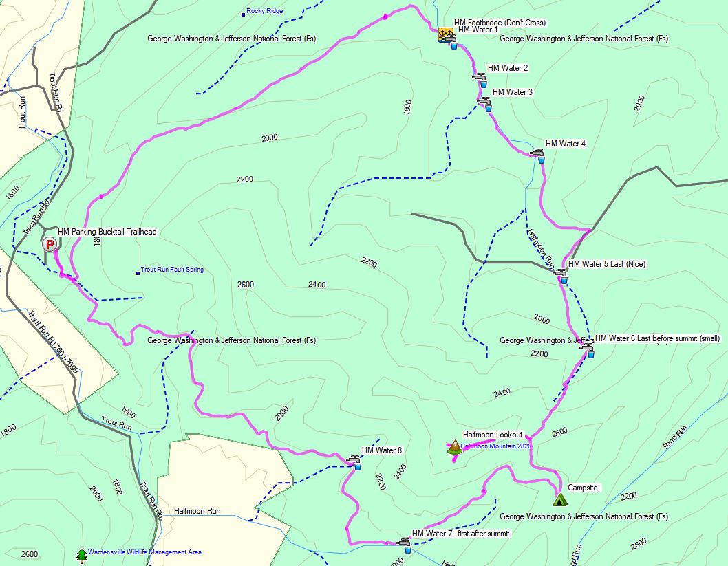
Route Overview – Halfmoon Mountail Loop – Sintax77

No permit is required to camp in the George Washington National forest, but there are rules and regulations regarding backcountry camping. You can find more information on the George Washington & Jefferson National Forest website here.

Full GPS track data, including campsites, water sources, etc, for this trip and many others can be downloaded on my Trip Data Page.

Continue reading

Grayson Highlands Route Planning – Solo Winter Backpacking Trip Pt 3

Creating a Backpacking Loop for my upcoming winter solo camping trip in Virginia’s Grayson Highlands.

For part three of this series, I’ll be going over my specific route selection for my solo backpacking loop, including trails used, potential parking / starting points, and expected camping areas for each night.  The map I chose to purchase for this trip, based on viewer feedback, was National Geographic’s Map #318 for the Mount Rogers High Country Grayson Highlands State Park region of Virginia.

A good portion of this loop will utilizing the Appalachian Trail, within the Mt Rogers National Recreation Area, as well as several other connecting trails within the Lewis Fork Wilderness and Little Wilson Creek Wilderness areas.

I will be doing continued updates throughout the whole process of planning this winter hiking trip. All the way from location selection, specific route planning, packing, food choices, getting there, doing the actual trip, and whatever else may come up in between, so check back for updates!