A Walk in the Woods – Hammock Camping the Old Loggers Path

Join me for 3 days of Hammock Camping & Ultralight Backpacking on the Old Loggers Path in Pennsylvania’s Loyalsock State Forest.

For this 3 day, 2 night spring backpacking trip, I’ll be hiking a roughly 28 mile backpacking loop along babbling brooks, waterfalls, hardwoods and hemlocks.  Being shoulder season in north central Pennsylvania, my weather ranged from highs in the 70’s down to just below freezing at night, with a little bit of rain sprinkled in for good measure.

Due to the weather, I packed some extra layers and a full set of rain gear.  This increased my pack weight a bit, but I still managed to come in with a base weight of around 10.5 lbs or so.  Water on the Old Loggers Path is fairly plentiful, so I got by with only carrying around 1 liter of water at a time.

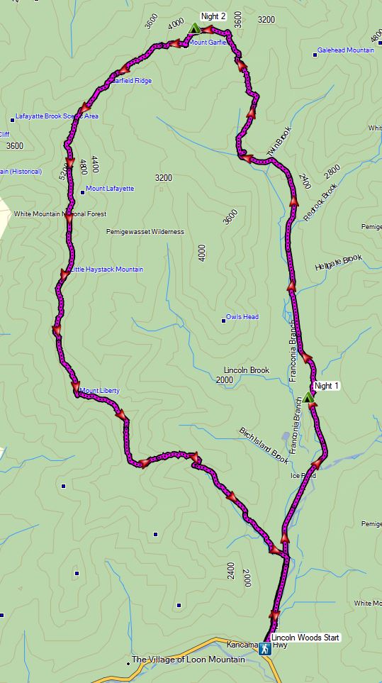
Trail conditions on the OLP are a mix of nice flat dirt sections, punctuated by spurts of steep sections littered with Pennsylvania’s infamous rocks to keep you on your toes ; literally.  Despite the occasional rough sections, the average daily gross elevation gain was only around 1,500 feet per day.  I chose to do the loop in a counterclockwise direction, as this allowed me to camp in the Rock Run area after only about 7 miles after my mid-day start on day one.


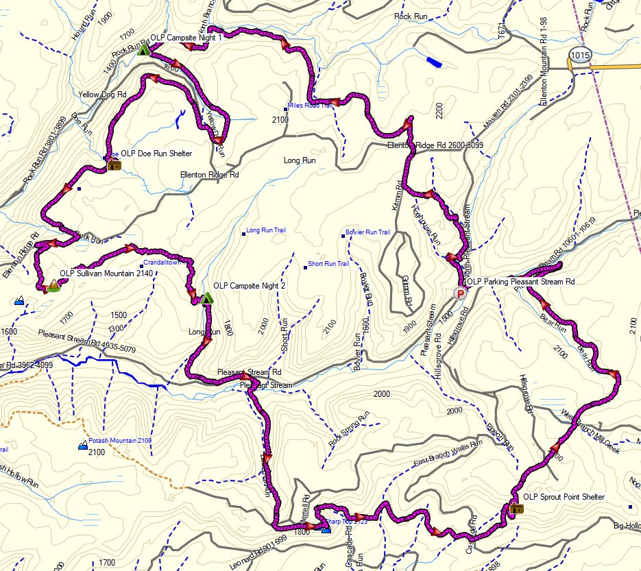
Old Loggers Path – Route Overview – Sintax77

No permit is required for dispersed camping in the Loyalsock State Forest, so long as you are only camping one night at each campsite.  You can find more information on the Loyalsock State Forest website here.

Full GPS track data, including campsites, water sources, etc, for this trip and many others can be downloaded on my Trip Data Page.

Continue reading

The Madness of Going Outside – Quarantine Backpacking & Cabin Trip

Backpacking on a Section of Pennsylvania’s Blcak Forest Trail.

Mike and I get Covid Cabin Fever and head out for a hammock camping & backpacking trip on a section of Pennsylvania’s Black Forest Trail in Tiadaghton State Forest with some great views of Pine Creek and the “Pennsylvania Grand Canyon”. We also pay a little visit to the cabin on the way back, for some camp chores and relaxation.

FTC Disclosure: This post contains affiliate links, which means I may receive a commission for purchases made through these links.

Trailhead Used
End of Naval Run Road
Slate Run, PA 17769
41°27’29.7″N 77°30’57.5″W

Notable Backpacking Gear (used by Sintax77)


Alone in the Pemi Wilderness – Winter Camping Adventure

3 Days of Winter Hammock Camping, Backpacking, & Snowshoeing in the White Mountains Pemigewasset Wilderness.

This trip was sponsored by Backcountry, who gave me the opportunity to upgrade three of my essential winter backpacking gear items for this trip. A gear list can be found at the end of this post.

FTC Disclosure: This post contains affiliate links, which means I may receive a commission for purchases made through my links, at no additional cost to you. Individual gear selections were made by me and all opinions are my own.

For this 3 day, 2 night spring winter camping trip, I’ll be hiking what amounts to a sort of “Half Pemi Loop”.  While a full pemi loop consists of the Franconia Ridge on one side and the Bondcliff ridge on the other, my plan was to use the lesser used Franconia Brook trail to go straight up the middle of the loop.  This would take me above treeline right near the summit of Mt Garfield, with the option to take either the Franconia Ridge to the west, or the Bondcliffs to the east in order to return to the Lincoln Woods visitor center where I had left my Jeep.

Even during “regular” backpacking season, the White Mountains are a quite challenging area to hike due to notoriously rapid changing weather conditions and steep, rugged terrain.  Add in some deep snow, ice, rain, high winds and a freeze / thaw temp range of 40° to 16° F, and things can get even more fun.  I had a great time, but it was probably the toughest solo winter backpacking trip I’ve ever done.

Winter Half Pemi Route Oveview – Sintax77

No permit is required to camp in the White Mountains NF, but there are rules and regulations regarding backcountry camping.  You can find more information on the USFS White Mountains website here. Some parking areas, such as the one I used for this trip, do require a vehicle fee of $5 per day.

Full GPS track data, including campsites, water sources, etc, for this trip and many others can be downloaded on my Trip Data Page.

Continue reading

Hiking the Ultimate White Mountains Backpacking Loop

3 Days of Hammock Camping, Hiking & Backpacking on the White Mountains Presicat Loop.

For this 3 day, 2 night summer backpacking trip, I’ll be hiking a 30 mile backpacking loop in New Hampshire’s White Mountain National Forest.  I call this the Presicat loop because it’s comprised of the Carter Range and Wildcat Range on one side, and the northern section of the Presidential Range on the other.

This route creates a grand tour of the northern White Mountains with a section of the Appalachian Trail and Mt Washington as it’s centerpiece.  Along the way we’ll hit 9 major summits (NH48’s) and 8 subsidiary peaks, while racking up 15,228 feet of elevation gain on some pretty rugged trails.

For sleep and shelter I chose a minimalist ultralight hammock camping system. This allowed me to get my base weight down to 9 lb.  Notable gear can be found in the gear section below. Or check out my full printable list with weights and links on LighterPack.

Presicat Loop Route Overview 2019 – Sintax77

No permit is required to camp in the White Mountains, but the trailhead I chose did require a self payment of $3 per day. Rules and regulations regarding backcountry camping can be found on the USFS website here.

Full GPS track data, including campsites, water sources, etc, for this trip and many others can be downloaded on my Trip Data Page.

Continue reading

Hammock Camping the Dolly Sods Wilderness – Solo Backpacking Trip

3 Days of Hammock Camping, Hiking, & Backpacking in the Dolly Sods  Wilderness.

For this 3 day, 2 night spring backpacking trip, I’ll be hiking a 23 mile loop in West Virginia’s Dolly Sods Wilderness, part of the larger Monongahela National Forest. Dolly Sods is located in the Allegheny Mountains on the highest plateau east of the Mississippi river and features some of the most varied and scenic terrain available to hikers in the Mid-Atlantic region.

For sleep and shelter system on my Dolly Sods backpacking loop, I packed in my Amok Draumr XL hammock, paired with the Amok Borg tarp and Amok Fjol XL sleeping pad.  I chose this combo based on plateau’s less aggressive terrain and the extra time I expected to be lounging and relaxing at camp.

No permit is required to camp in the Dolly Sods Wilderness, but there are rules and regulations regarding backcountry camping. You can find more information on the USFS Dolly Sods website here.

Full GPS track data, including campsites, water sources, etc, for this trip and many others can be downloaded on my Trip Data Page.

Continue reading

Hammock Camping on an Abandoned Mountain Farm – Quehanna Trail Ultralight Backpacking

Hammock Camping, Hiking & Ultralight Backpacking on the Quehanna Trail.

Yes, we’re once again camping in the rain. 🙂 For this overnight backpacking trip, I’ll be hiking a 22 mile loop in Pennsylvania’s Quehanna Wild Area, within the greater Moshannon State Forest.  Luckily, I learned from my last camping trip, and packed more adequate rain gear this time.

Itching for another hammock camping trip, I decided to have some fun and go back to more of an ultralight backpacking load-out for this adventure, clocking in at roughly 8.5 pounds base weight.

My full backpacking gear list, with weights & gear links is available on this lighterpacks.com link. A truncated notable backpacking gear list can be found at the bottom of this post.

Quehanna Short Loop – Route Overview – Sintax77

No permit is required to camp in the Quehanna Wild Area or the greater Moshannon SF.

Full GPS track data, including campsites, water sources, etc, for this trip and many others can be downloaded on my Trip Data Page.

Continue reading